|
|
Maps
|
|
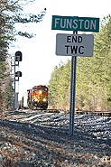
Disclaimer: Most of these maps are not “official” maps produced by Norfolk Southern; rather most were drawn by T&E employees who wanted to document & share this information with future generations & make their experiences a little easier. Therefore, use these renderings with care, they are not exact. Always take the safe course of action if you are unsure, with or without a map. Special thanks to D.C. Lannon & D.G. Stevens for their hard work on many of these maps & allowing BLET Division 375 to make them available through this website.
|
|
 Listing of distances (where will your train fit?) by MD Lovette Listing of distances (where will your train fit?) by MD Lovette
|
|
Yard & industry spot maps -by DC Lannon (108 maps in 1 pdf file!)
|
|
Misc. maps and track Charts: CP&L Brickhaven, CP&L Goldsboro, Goldsboro Yard, Goldsboro Milling, Hurt Connection, J Line, Raleigh (Glenwood Yard,), Selma, Shelton Quarry & more.
|
|
Roanoke terminal diagrams (includes V Line signal list) -by WS Link
|
|
Yard & industry maps -by DG Stevens: Boylan -Fetner, NC, Dundee, Glenwood, CP&L Goldsboro, Goldsboro Milling, Linwood, Montview, Pomona, Roanoke, & Selma.
|
|